Met Office 15 Hour Warning – Areas Affected, Risks and Advice
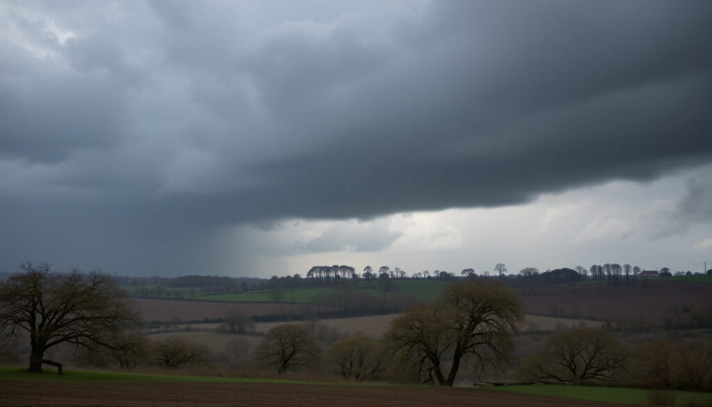
The Met Office has issued multiple yellow weather warnings across the United Kingdom, with some extending up to 15 hours in duration. These warnings come as saturated ground from recent storms raises significant concerns about flooding and travel disruption across multiple regions.
The warning period includes a 15-hour alert from 6pm through 9pm the following day in some areas, while another instance stretches approximately 27 hours. Forecasts indicate rainfall of 15-25mm in many places, with some spots potentially receiving 30-100mm of rain within 24 hours, according to official Met Office announcements.
Communities spanning Scotland, northern England, southwest England, and parts of Wales and central southern England fall within the warning zones. Officials emphasize that the prolonged nature of these alerts reflects the persistent low-pressure systems affecting the country, with conditions expected to develop over several days.
What is the Met Office 15 Hour Warning?
The Met Office 15-hour warning represents a yellow-level weather alert issued to inform the public of potentially hazardous conditions expected over an extended period. Yellow warnings serve as the lowest severity level in the UK weather warning system, signaling that individuals should “be aware” of possible disruptions including local flooding and travel issues.
The extended 15-hour duration reflects the slow-moving nature of the weather system bringing heavy rain across multiple regions. According to the Met Office, warnings are issued up to seven days in advance and remain subject to change as conditions evolve.
Key Insights
- Some regions could experience a month’s worth of rain within a 24-hour period, with widespread totals of 30-50mm and locally higher amounts of 60-80mm or exceeding 100mm
- Saturated ground from prior storms significantly increases flood risk, making surface water pooling and river overflows likely outcomes
- Strong easterly winds with gusts exceeding 60mph are possible in western and northwestern Wales areas
- Snow warnings overlap with rain alerts in northern Scotland and higher elevations above 100-200 metres, with accumulations of 1-20cm forecast
- Travel delays, difficult driving conditions, and potential road or rail closures are expected across warning zones
- The situation remains dynamic, with new warnings possible as weather systems develop
- Yellow warnings, while the lowest severity level, carry significant weight given current ground saturation levels
Snapshot Facts
| Fact | Details |
|---|---|
| Issuing Body | Met Office |
| Maximum Duration | 15 hours (extending to approximately 27 hours in some instances) |
| Severity Classification | Yellow (be aware) |
| Rainfall Forecast | 15-25mm widely; 30-100mm locally in 24 hours |
| Wind gusts | Exceeding 60mph in exposed coastal and Welsh areas |
| Snow accumulations | 1-20cm above 100-200m elevation in northern Scotland |
| Ground conditions | Saturated from recent prior storms |
| Warning advance notice | Issued up to 7 days ahead, subject to change |
Which Areas Does the Met Office 15 Hour Warning Affect?
The Met Office yellow warnings span a broad geographical sweep across the United Kingdom, with distinct regional patterns emerging based on the weather system’s trajectory and local topography.
Scotland
Much of Scotland falls within the warning zone, with particular emphasis on border regions, Dumfries and Galloway, Strathclyde, and northern areas. These regions face combined hazards of heavy rain and snow, especially at higher elevations where accumulations of 1-20cm are possible above 100-200 metres.
Northern England
Areas including Cumbria, Northumbria (Northumberland), Yorkshire, and the Lake District face significant rainfall totals, with some southern Scottish hills potentially receiving up to 100mm. The combination of already saturated ground and anticipated rainfall raises serious flooding concerns for these communities.
Southwest England and Wales
Southwest England continues to experience significant rainfall in areas already saturated from prior storm systems. Southeast Wales, the Midlands, and southern England face prolonged heavy rain expected Friday into Saturday, with east-facing hills at highest risk. Strong easterly winds accompanying the rain in western and northwestern Wales may exceed 60mph in gusts.
The Met Office provides interactive live maps on their warnings page, colour-coded by severity. Yellow indicates “be alert,” amber signals likely disruptions, and red denotes danger. Visiting the official warnings page allows you to enter your location for specific local information.
What Impacts Are Expected from the Met Office 15 Hour Warning?
The convergence of heavy rainfall, saturated ground conditions, and prolonged warning duration creates a compound risk scenario across affected regions. Officials warn that the potential for disruption extends beyond immediate flooding to encompass infrastructure stress, travel complications, and isolated community impacts.
Flooding Risks
Surface water pooling and river overflows represent the most immediate threat as rainfall encounters ground already saturated from recent wet weather. Some areas could receive a month’s worth of rain within a single 24-hour period, with widespread totals of 30-50mm and locally higher amounts of 60-80mm or exceeding 100mm possible.
There remains a small chance that communities could become cut off or that flooding could pose a danger to life, particularly in low-lying areas and regions with poor drainage infrastructure. Environment Agency teams are monitoring river levels closely across warning zones.
Travel and Infrastructure Disruption
Road and rail closures, travel delays, and difficult driving conditions are expected as the weather system moves through. Blizzard-like conditions may develop in areas receiving snow, particularly in northern Scotland and higher elevations. Power cuts remain a possibility across multiple regions.
Those planning journeys should allow extra time and check current road conditions and closures before departing. In areas affected by snow warnings, motorists should exercise particular caution and be prepared for rapidly changing conditions. For airport-related travel, reviewing options like Heathrow Airport Drop Off – Charges, Locations and How to Pay in advance can help manage logistics during disruption.
Duration and Persistence
Low-pressure systems driving these warnings show persistence over multiple days, meaning conditions may not immediately improve after initial warning periods expire. The Met Office classifies some rain warnings as medium impact despite very low likelihood, reflecting the serious potential consequences should worst-case scenarios materialise.
Timeline of the Met Office 15 Hour Warning
The warning sequence unfolds across several distinct phases, with new alerts supplementing ongoing conditions as the weather system develops. The following timeline outlines key moments in the warning cycle.
- Warning issuance – Met Office publishes initial yellow warnings covering affected regions, with durations ranging from 15 to 27 hours depending on location
- Immediate period – Southwest England heavy rain warning from 6pm through 9pm following day; north Scotland snow warning from midnight to 3pm Wednesday
- Short-term development – Rain heaviest overnight, clearing Tuesday but persisting in northeastern areas; wind and rain continuing through Wednesday in southern Wales and southwest England with 15-40mm additional rainfall
- Friday-Saturday alert – New warning issued for England and Wales from 0600 Friday through 0600 Saturday covering prolonged heavy rain
- Follow-up updates – Met Office continues monitoring and will issue additional warnings as conditions evolve; situation particularly dynamic given saturated ground raising flood risks
Warnings are subject to change as conditions develop. For the most current information, monitor the Met Office news and media centre and their social media channels, which include warning maps showing affected areas.
Confirmed Facts Versus Remaining Uncertainty
While official sources provide clear information on certain aspects of the warning system, other details remain contingent on how conditions develop. Understanding what is established versus what remains uncertain helps communities prepare appropriately.
| Established Information | Information That Remains Uncertain |
|---|---|
| Official duration extends to 15 hours in some cases, with specific instances reaching approximately 27 hours | Exact rainfall amounts will vary locally and remain contingent on weather system behaviour |
| Affected regions include Scotland, northern England, southwest England, Wales, and central southern England | Secondary impacts such as specific flood locations and severity remain difficult to predict precisely |
| Met Office is the issuing authority for all UK weather warnings | Whether warnings will be upgraded to amber or red depends on how conditions develop |
| Yellow-level warnings indicate “be aware” status within the warning hierarchy | Exact timing of peak impact windows may shift as the weather system moves |
| Ground conditions are saturated following recent prior storms | Community isolation incidents, if any occur, cannot be predicted with certainty |
| Warnings are issued up to seven days in advance and subject to change | Total duration of the unsettled weather pattern depends on incoming Atlantic systems |
Background and Context
The current warning sequence reflects a broader pattern of unsettled weather affecting the United Kingdom. Persistent low-pressure systems have brought repeated rainfall across multiple regions in recent days, leaving ground saturated and drainage systems strained.
The Met Office warning system operates on a three-tier colour scale: yellow for awareness, amber for likely disruptions, and red for danger. Yellow warnings, while representing the lowest tier, carry particular significance when ground conditions are already compromised, as the threshold for impactful flooding and travel disruption decreases substantially.
Those interested in regional weather patterns may find it useful to explore local forecasts. For residents of Warwickshire, detailed information about conditions in the area is available through resources such as Weather in Stratford upon Avon – Hourly Forecast and 10-Day Outlook.
Official Sources and Statements
The Met Office serves as the primary authoritative source for UK weather warnings, operating as the national meteorological service with official government status. All current warning information originates from their forecasts and press releases.
“Warnings highlight risks from saturated ground after recent wet weather, with potential for 30-100mm of rain in 24 hours in some spots.”
— Met Office media centre statement, November 2025
Supporting agencies including the Environment Agency for England, the Scottish Environment Protection Agency (SEPA), and Natural Resources Wales provide local flood guidance and river monitoring data. These bodies work in conjunction with the Met Office to deliver comprehensive weather impact information to affected communities.
For those requiring the most current information, the Met Office official website and their government department page provide regular updates. The warnings page offers interactive maps showing current alert zones across the United Kingdom.
Summary and Key Takeaways
The Met Office has issued yellow weather warnings extending up to 15 hours, with some alerts spanning approximately 27 hours, across Scotland, northern England, southwest England, Wales, and central southern England. These warnings reflect heavy rainfall potentially delivering a month’s worth of precipitation in 24 hours for some areas, combined with saturated ground conditions that significantly elevate flooding risk.
Communities within warning zones should remain weather-aware, prepare for potential travel disruption, and monitor official sources for updates as conditions develop. The combination of heavy rain, strong winds in exposed areas, and snow in northern and elevated regions creates a multi-hazard scenario requiring careful attention to safety guidance.
Frequently Asked Questions
What does a Met Office yellow warning mean?
A yellow warning indicates the lowest severity level in the UK warning system. It means to “be aware” of possible disruptions such as local flooding and travel issues. While less severe than amber or red warnings, yellow alerts still warrant attention, particularly when ground conditions are already compromised.
How long does the Met Office 15-hour warning last?
The 15-hour duration refers to specific warning periods, with some instances extending to approximately 27 hours depending on the region and weather system. Warnings may be extended or supplemented with additional alerts as conditions develop.
Which parts of the UK are most affected by the current warnings?
Scotland, northern England (including Cumbria, Northumbria, and Yorkshire), southwest England, Wales, and central southern England fall within the warning zones. Specific impacts vary by location, with some areas also facing snow at higher elevations.
What should I do to prepare for the heavy rain warning?
Those in affected areas should check their property’s flood risk, clear drains of debris, and adjust travel plans accordingly. Staying informed through the Met Office, Environment Agency, SEPA, and Natural Resources Wales provides access to the latest guidance.
Where can I find the latest Met Office warning maps?
The official Met Office warnings page offers interactive live maps colour-coded by severity. Visitors can enter their location for specific local information about current and forecast conditions.
Could the yellow warning be upgraded to amber or red?
Warnings remain subject to change based on how conditions develop. The Met Office monitors situations continuously and can upgrade or extend warnings as weather systems evolve. Monitoring official sources provides the most current assessment of severity.
Are there travel disruptions expected from this weather warning?
Travel delays, difficult driving conditions, and potential road or rail closures are expected across warning zones. Blizzard-like conditions may develop in areas receiving snow. Those planning journeys should allow extra time and check current conditions before departing.
More related posts
 Mystic Meg Daily Horoscopes – Archives Access Guide
 What to Have for Dinner – Quick Vegetarian Keto Meals
 What Does SN Mean – Slang on Snapchat, Texting and Social Media
 Hawes and Curtis Shirts – Quality, Fit and Manufacturing Guide
 B&Q Watford – Opening Hours, Address and Store Services
 Cut and Craft Leeds – Menu Reviews Halal and Booking Guide
 Can Dogs Eat Eggs – Safety, Benefits & Feeding Guide
 Average Height for Women – UK US Europe Worldwide Stats